
Freeport Neighbors Block Sources
A block record can establish parcel geometry, tax administration, a dated deed event, or a public community contact. It cannot safely turn a map into a roster. Start with the parcel map, then examine each adjoining parcel separately. The final roll can identify a recorded owner and mailing address for its parcel. A recorded owner may not occupy the site, and a mailing address can be outside Freeport. The community directory is useful for public organizations, not for membership.
| Source | What It Shows About a Block | Access |
|---|---|---|
| Nassau GIS and Land Records Viewer | Parcel geometry, parcel address, PARID, PARCEL, ROLL_YEAR, lots, roads, boundaries, and aerial context | Online map and Identify tool |
| Village final roll | SBL, situs, recorded owner, owner mailing address, class, assessment, exemption, and tax fields for each parcel | Village assessment record |
| County Clerk deeds | Conveyance parties, legal description, document details, and chain clues for an adjacent SBL | Current portal, historic repository, or public terminal |
| Historic map sources | Street and lot layout, building footprint or use, and development context at a stated date | LRV layers, Library material, and 1910 Sanborn sheets |
| Village community directory | Public organization names, addresses, and phones with category, letter, and name filters | Municipal directory, 38 results in the inspected view |
For Freeport neighbors, record a source date next to each result. A current roll, a 1950 map, and a dated civic agenda each describe a different time and purpose.
Map Freeport Neighbors From One Parcel
The adjacent-parcel method uses the map rather than an assumed street sequence. A parcel is a mapped legal or tax unit, not a statement about a household. Start with the target address in the Nassau Land Records Viewer, switch on parcels, lots, roads, village boundary, and aerial layers, then use Identify on the target and on every polygon that directly touches it. Record the adjacent PARID or PARCEL, situs address, lot geometry, and roll year before looking at an owner field.
- Find the target in the Nassau Land Records Viewer map and confirm its address or SBL.
- Activate parcels, lots, roads, administrative boundaries, and aerial imagery. Identify the target polygon first.
- Identify each adjoining polygon and save its PARID, PARCEL, PARCEL_ADDRESS, and ROLL_YEAR.
- Check whether a polygon is a road, rail corridor, park, lot group, unit, utility area, or a cross-street property before calling it a neighbor parcel.
- Read each corresponding final-roll line and deed trail separately. Do not merge adjacent parcels into one household.
The Nassau parcel map presents the Freeport layers, search controls, Identify tool, and measurement functions used for this block method.
Map geometry is the first check because an apparent next-door address may not share a boundary. It also prevents a cross-street or public parcel from being treated as a private neighbor record.
Read Freeport Neighbor Roll Lines Separately
Once the adjacent polygons are fixed, consult the Village final roll one parcel at a time. The inspected 2026-27 roll displays tax-map parcel ID, current owner name, school district, property location and class, owner mailing address, parcel size or grid coordinate, assessment, exemptions, tax description, special districts, and Village taxable value. It can also show a deed book or page in the property line or related detail. Those fields belong to the parcel, not to a claim about an entire block.
AROW is a useful second check because it requires Street and ZIP, and it can accept House Number, City or Postal Name, and Section, Block, and Lot. The Nassau AROW locator shows that property-search field arrangement.
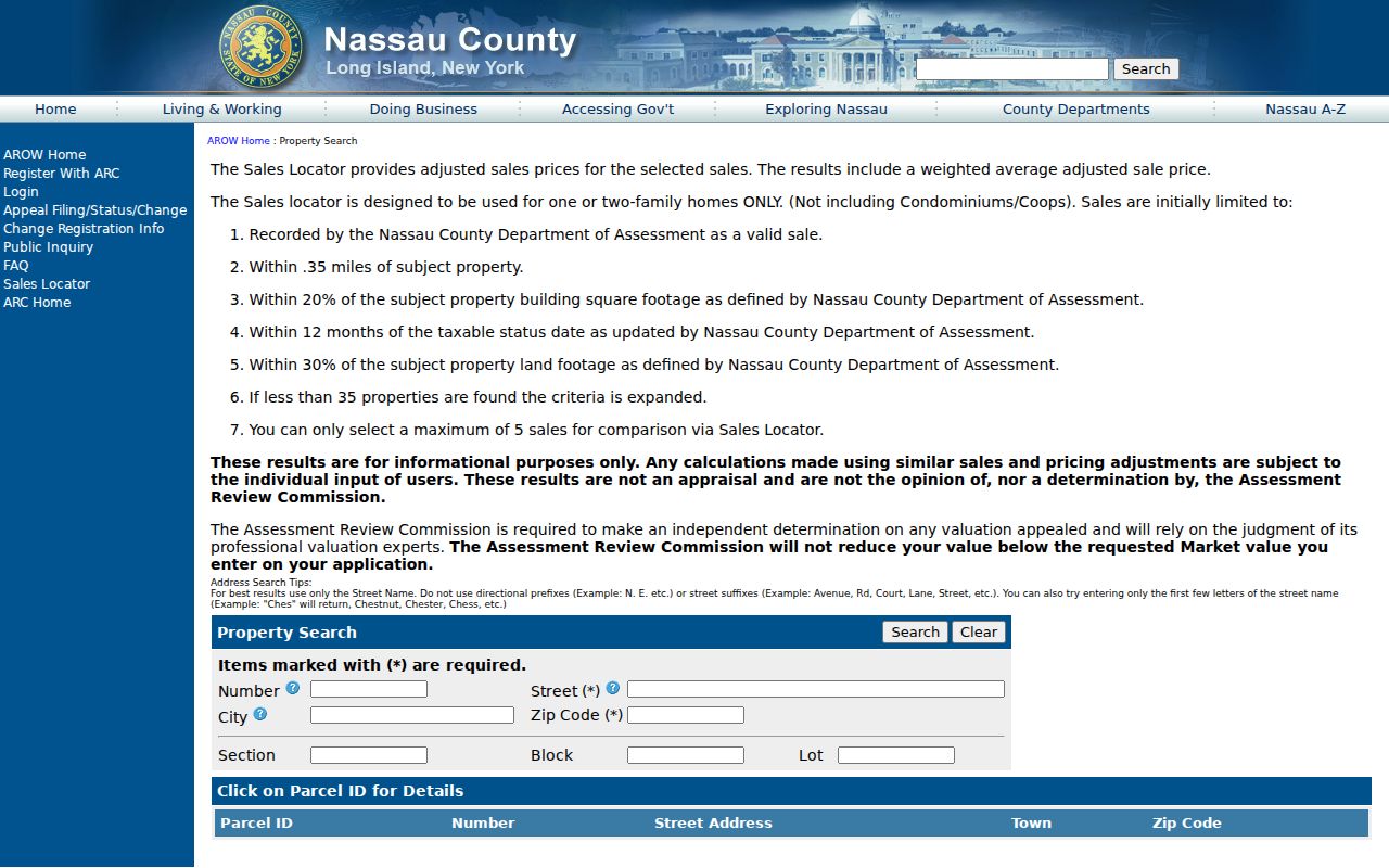
The final roll’s 81 Lillian Ave example is a useful caution: it gives a Freeport situs but an owner mailing address in Merrick. A mailing address is tax-notice information. It does not settle who occupies the Freeport property or the Merrick address.
Note: Record the exact owner spelling and role from the roll, but do not expand initials or copy sensitive contact details into a block worksheet.
Freeport Neighbors Across Map Years
Historic layers add a time dimension to a Freeport block. The Land Records Viewer includes Nassau County 1926 and 1950 toggles, along with later New York aerial and topographic layers. The Library’s house-history resources name local tax maps for 1915, 1925, 1930, and 1935. The Library of Congress holds the 1910 Freeport Sanborn set in 30 sheets. These maps can show a street edge, lot arrangement, or building footprint at a stated date. They do not identify occupants.
The Nassau Land Records Viewer address search is the route from a current target address to the parcel map and its historic layer controls.
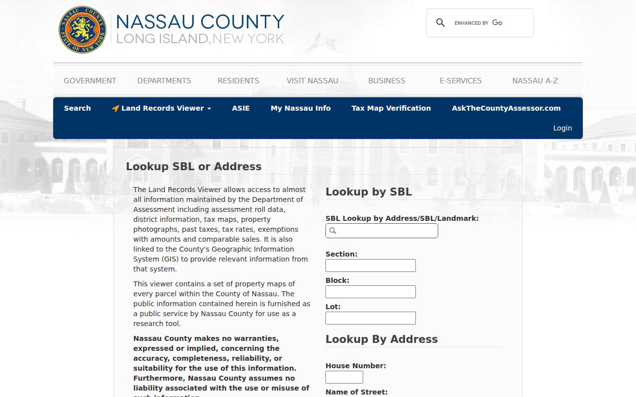
Compare the current parcel outline with the older map before deciding that a lot was always separate or that a street label has the same meaning today. No official Freeport street-renumbering schedule was found, so an old-to-new address conversion must remain a verified research question.
Freeport Neighbor SBLs and Deed Chains
Each adjacent SBL can be checked through the same land-record method, but a block should not be treated as one title chain. Start with the current roll or Land Records Viewer, then search the County Clerk current portal by SBL or party. Compare the grantor, grantee, recording date, book or document number, and legal description to the map. A legal description is the lot, block, map, or other land wording that confirms the property involved in a deed.
The SBL has a local complication: Nassau assessment systems and the County Clerk can format it differently. Keep the source version and normalize it for the Clerk search instead of assuming that a failed string proves no deed exists. The Clerk’s historic repository provides Direct and Reverse Index Books, with Index Books covering 1840 through 1934. The county reports registry history for deeds, mortgages, and maps from 1899, but neither statement guarantees every record is digitized.
For the complete named-street chain after the immediate block is understood, use the Freeport Street Directory. A block method stays focused on adjoining polygons and their distinct records.
Freeport Neighbors Civic Layer
Public community contacts can add civic context to a block without turning organizations into personal rosters. The Village community directory has an A-Z or ALL letter filter, a category filter, a name field, Search control, and paginated results. The inspected directory showed 38 results, with public organization addresses and phones. It includes groups and congregations such as B’nai Israel, Bethel AME, Bethlehem Assembly, Centro Christiano, Christ Lutheran, Church of God, LDS, Church of the Transfiguration, Community Church of the Nazarene, and Cornerstone. Listing a public organization does not establish membership.
Village Community Directory
Search the municipal directory by category, initial, or organization name. It is a public-organization index, not a directory of Freeport neighbors.
Police Community Affairs
Freeport Police lists Community Affairs at 516-377-2425 for civic and neighborhood contact. Its meeting route is a way for committees, associations, and nonprofits to request a representative.
Stearns Park Civic Association
A January 2025 Village legislative agenda documents an association project involving landmark pillars at 479 Pennsylvania Avenue and 171/172 Prince Avenue. It is a lead for public meeting material, not a membership roster.
There is no verified complete official roster of Freeport civic associations, block clubs, or neighborhood-watch groups. For live discovery, use the community directory and the Police Community Affairs route rather than guessing from a street name.
Freeport Neighbors: Record Tools Compared
Official records and commercial neighbor-search categories serve different purposes. The official sources can be checked against a named custodian, parcel, map year, or document number. Commercial tools may be convenient but can combine stale, mismatched, or unexplained data. Neither category supports a conclusion about every person on a block. For a Freeport question, use the official record that matches the specific parcel, historical date, or civic contact needed.
| Source category | Best use | Limit |
|---|---|---|
| Official parcel and final-roll records | Map a parcel, identify a recorded owner role, and distinguish situs from mailing address | Do not establish current occupancy or household composition. |
| County deed records | Check conveyance parties and legal parcel history | Parties to a deed are not a current block roster. |
| Historic maps and directories | Place a block in a dated physical or historical context | They are date-bound and incomplete for current questions. |
| Commercial neighbor-search category | General lead only, if lawfully considered | Accuracy, source dates, and matching logic may be unclear; do not rely on it as a record custodian. |
A source citation, roll year, and map date make the official result reviewable. Those basic details matter more than an unverified compiled profile.
Freeport Neighbors Privacy Limits
Parcel records can identify a legal property relationship, while voter lookup is only for an individual who can be searched with the required identity information. New York voter-file FOIL requests require an Election Law §3-103(5) elections-purpose statement and are not a route to create a block roster. Protected voter records, sealed court material, and Address Confidentiality Program information must stay protected. Do not use police, delivery, utility, or private contact information to fill gaps in a parcel map.
Lawful use. Freeport neighbors research can support historical, civic, family, property, and safety questions. Do not use it to stalk, harass, threaten, impersonate, or harm another person.
When a result is ambiguous, keep the narrow conclusion: the polygon, SBL, map date, or public organization. Stopping there respects privacy and keeps the block record accurate.