
Trace a Freeport Street by Address
Start with the full postal form of the address, then keep a second search form for the Nassau property tools. The public record trail is strongest when the same parcel, source date, and record role agree. Nassau assessment data can identify the recorded owner of a parcel, but it does not establish who occupies it. The New York voter form is only for confirming a known voter with the required identity inputs. Dated directories and yearbooks can add historical context, yet they are not proof of a current household.
- Use USPS ZIP Lookup to retain the standardized address and ZIP for citation. USPS confirms delivery formatting, not a person or organization at that address.
- Enter the street and ZIP in Nassau County’s AROW property locator, adding a house number when known. Save the parcel identifier and successful search wording.
- Check the Nassau Land Records Viewer and the Village final roll for the situs, SBL, map, assessment, tax, and owner fields.
- Use the SBL, party name, book and page, or document number in the County Clerk land-record route to test the deed sequence and legal description.
- Use the state voter lookup only to verify a known individual. It requires last name, first name, date of birth, county, address information, and ZIP.
- For a past household, consult the Freeport Library’s address and name transcriptions or a dated directory rather than treating today’s roll as a history of the street.
Write down whether each hit is a postal result, parcel record, owner record, conveyance party, or dated person clue. That short label prevents a common error: turning an ownership record into an assertion about current residence.
Freeport Street Directory Search Forms
Nassau’s two property interfaces use different forms of the same address. In the Land Records Viewer, the address form labels House Number, Name of Street, Town, and Zip. Its instructions say to omit directional words and street suffixes. AROW requires Street and Zip Code, then allows House Number, City or Postal Name, and Section, Block, and Lot. Preserve the complete USPS form in your notes even if the successful property query is shortened.
| Tool | Field pattern | Freeport street-directory use |
|---|---|---|
| Land Records Viewer address form | House Number, Name of Street, Town, Zip, all optional | Find the map and assessment record; omit directional words and suffixes. |
| Land Records Viewer SBL form | Section, Block, Lot, all optional | Return to the parcel once an address has been normalized. |
| AROW locator | Street and Zip required; house, city or postal name, SBL optional | Confirm the parcel and review property or sales context. |
| GIS parcel layer | PARCEL_ADDRESS, PARID, PARCELKEY, PARCEL, ROLL_YEAR | Use the geometry and parcel keys, not as an occupant search. |
The AROW property and sales locator shows the required street-and-ZIP starting point used in a Freeport street directory search.
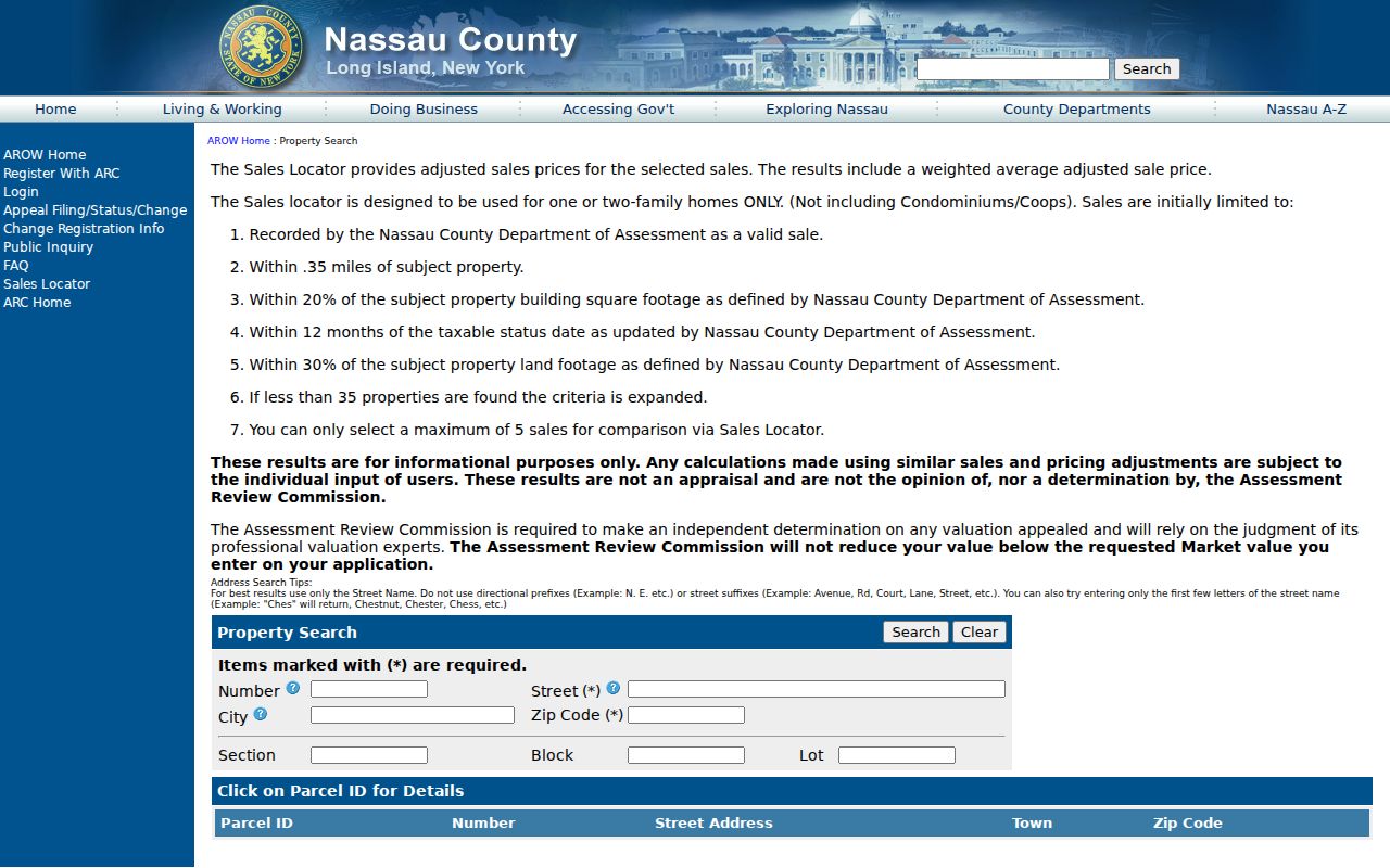
Use the optional SBL fields after an address result is found, especially when a street spelling or postal name produces more than one possible parcel.
Map a Freeport Street Before Names
The Land Records Viewer is the address-first map for Freeport street work. Turn on parcels, lots, roads, village boundaries, and aerial imagery before interpreting a result. The GIS parcel layer supplies PARCEL_ADDRESS, PARID, PARCELKEY, PARCEL, and ROLL_YEAR, while its geometry explains why a long street may include a road corridor, park parcel, lot group, or cross-street address. Those polygons are places in the map, not necessarily separate households.
The Nassau parcel map exposes Identify and measurement tools alongside parcel, boundary, road, and imagery layers.
Historic Nassau 1926 and 1950 layers, plus the 2013 aerial, help test street alignment and development changes. They do not name people, so pair them with a dated record only after the parcel has been fixed.
Note: The GIS service supports spatial queries and pagination, but the inspected layer has no field that identifies an occupant.
Freeport Street Directory Record Coverage
Address-keyed sources overlap, yet their meanings differ. Use the table to choose the narrowest source for the question. A village final-roll line is valuable for current parcel administration. A County Clerk document records a legal transaction. A building record may date an application or change. None should be expanded into a list of everyone associated with a street.
| Address record | Freeport or Nassau keeper | What it can show | Access route |
|---|---|---|---|
| Village final roll | Village Assessor | SBL, situs, owner, mailing address, class, assessment, exemptions, tax, and possible deed book or page | Village roll and Assessor inquiry |
| Land Records Viewer | Nassau County | Maps, assessments, taxes, property photos, sales, districts, and linked GIS | Online viewer |
| GIS parcel layer | Nassau GIS | Parcel geometry, parcel address, identifiers, and roll year | Map and GIS service |
| AROW locator | Nassau County Assessment | Property and sales results tied to Street and ZIP | Online public inquiry |
| Deed indexes | Nassau County Clerk | Grantor, grantee, legal description, recording details, book or document reference | Current portal, historic repository, or public terminal |
| Village permit or board file | Freeport Building or Clerk | Address-bounded application, permit, plan, complaint, or board material where public | OpenGov inspection, clerk counter, or FOIL |
For Freeport street directory work, retain the original SBL string and the property tool that produced it. Nassau’s assessment and County Clerk systems can format the same SBL differently. That asymmetry can create a false no-result unless the clerk’s format is used for the deed search.
Read Freeport Parcel Roles Correctly
A parcel is a mapped piece of land identified in the assessment system. The situs address is its physical property location. A mailing address is where the owner receives assessment notices. The Village final roll makes the distinction visible. Its line for 81 Lillian Ave shows a Freeport situs and an owner mailing address in Merrick. That identifies the tax-notice destination, not an occupant at either place.
- Parcel
- A mapped tax or land unit that can be tied to an SBL, geometry, and assessment record.
- Situs address
- The physical location assigned to the parcel for property and assessment use.
- Legal description
- The lot, block, map, or other land description used to confirm the property in a deed.
- Criss-cross directory
- A dated directory arranged so an address can lead to a listed name, or a name to an address.
The roll also distinguishes tax, assessment, exemption, and market-value fields. A value or exemption category does not establish a person’s income, service status, or presence at the property.
Follow Freeport SBLs Into Current Deeds
After the map and final roll point to a parcel, move to the current County Clerk route with the SBL or owner name. If a result is unclear, use the book and page printed in a roll line where present. Check the recording date, grantor, grantee, document number, and legal description against the parcel map. A grantor is the party conveying an interest; a grantee is the party receiving it. Neither label proves a current address or household.
The official Nassau County Clerk Land Records II portal is the current land-record entry point and also provides the county property-fraud alert route.
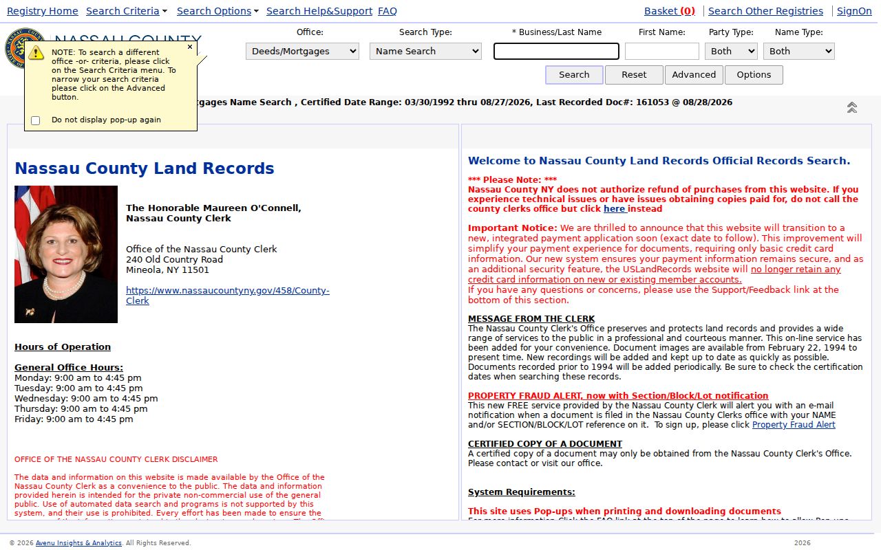
The current portal’s detailed controls and image rules were not fully captured in the research. When an online result is incomplete, the Clerk provides public terminals and document-request channels at 240 Old Country Road in Mineola.
Freeport Street Deeds in Historic Indexes
The historic County Clerk repository is useful when a Freeport street directory search turns into address history. It offers Index Books for 1840 through 1934, along with Direct Index Books and Reverse Index Books. The County Clerk reports registry history for deeds, mortgages, and maps from 1899, while its electronic database work began in 1992. Those are distinct coverage statements, not a promise that each instrument has an online image.
The historic Official Records repository includes optional document-name or book-number, record-type, document-text, and year-range controls.
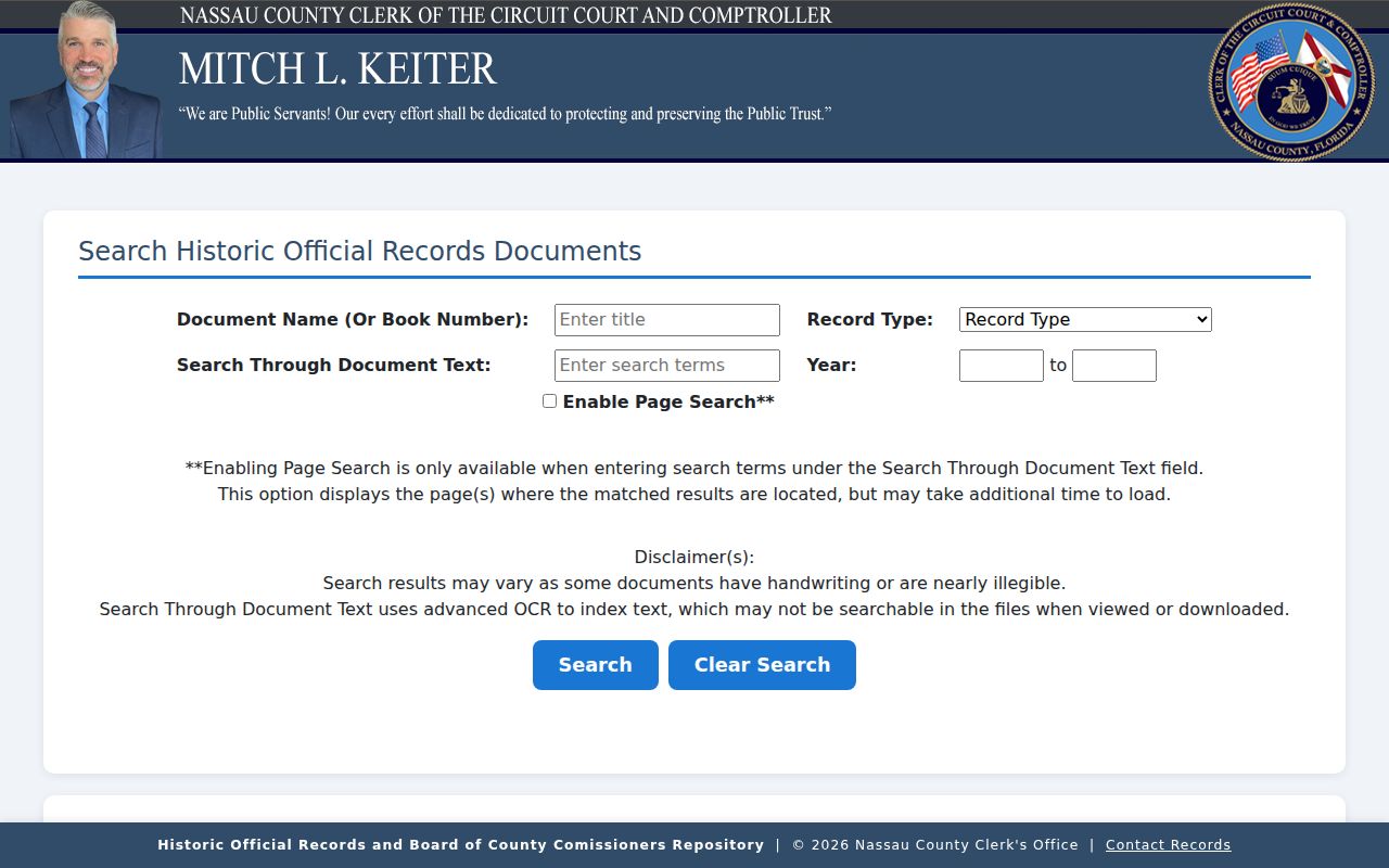
Its repository says it has no documents after 1982. OCR can also miss handwriting or unclear text. Search both grantor and grantee names, then compare the legal description and SBL before adding a prior conveyance to the street record.
For old address clues, the Freeport Memorial Library’s house-history guide points to 1915, 1925, 1930, and 1935 tax maps and 1934/35 address-name transcriptions. The collections are the better follow-up for a dated household clue; they are not a substitute for the current parcel record.
Freeport Street Changes in Village Files
Property changes can leave a municipal trail without identifying a resident. The Freeport Building Department handles building, plumbing, electrical, property-maintenance, multiple-residence, public-assembly, and unsafe-building matters. Its Building Permits page directs permit activity through OpenGov, but the research did not capture the live search fields or historical coverage. Treat that as a gap, not a reason to assume an online address search exists.
For a bounded record request, name the address, date range, department, and type of existing record. The Village Clerk is at 46 N Ocean Ave, and the FOIL route accepts requests at villagefoil@freeportny.gov or by mail. A permit applicant, contractor, owner, or board petitioner can be different people with different roles.
Note: Ask the custodian for public records and any lawful redactions rather than requesting a general list of names connected to a street.
Freeport Street Map Years Matter
Address history needs map years as well as names. The Land Records Viewer has historic Nassau 1926 and 1950 layers. Freeport’s 1910 Sanborn coverage has 30 sheets, and the Library’s local-history material names tax maps for 1915, 1925, 1930, and 1935. Compare a target parcel across those sources before deciding that a vanished address reflects a renumbering or a missing household.
No official Freeport street-renumbering schedule or annexation-and-renumbering map was found in the research. The absence is important. Record the old map label, current address, SBL, and source date rather than supplying an unverified conversion. For a whole named street after the modern parcel check, the dated household material belongs in the Freeport City Directory collections.
Freeport Street ZIP Checks
Postal geography is another reason to keep two address forms. The incorporated Village’s normal ZIP is 11520, while 11575 is an adjacent Roosevelt postal-area question, not a confirmed Village ZIP for every address. USPS controls the exact delivery result. The Land Records Viewer’s village-boundary layer controls a separate municipal-boundary check. Neither result names an occupant.
The Land Records Viewer address search accepts house number, street, town, and ZIP, and is useful once USPS has normalized the address.
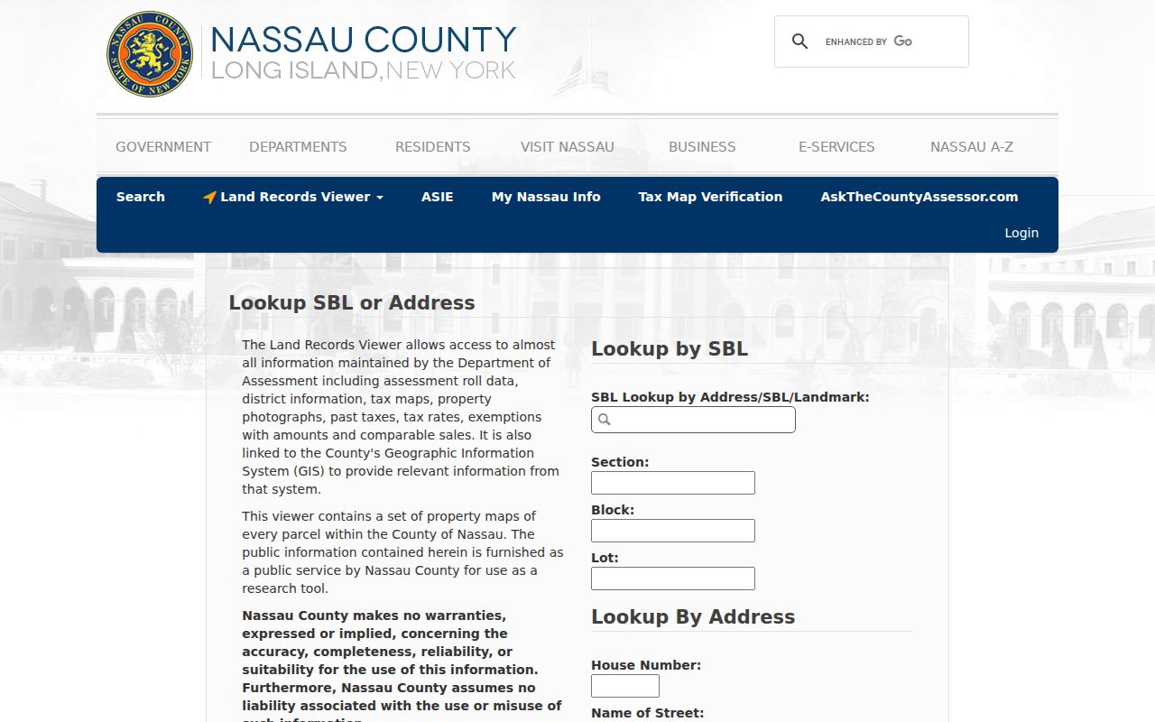
Use the full postal address for a citation, then try the shortened street form required by LRV or AROW. The Freeport ZIP Code Directory explains the 11520 and 11575 boundary issue in more detail.
Freeport Street Directory Privacy Limits
A street record can show a legal parcel, recorded owner, tax-mailing address, or dated directory entry. It cannot safely fill in every person associated with an address. New York’s Address Confidentiality Program can provide an eligible participant with a substitute mailing address, and voter records can be confidential. The individual voter form is not a public street roster. Do not combine protected data, signatures, dates of birth, or private contact details into an address profile.
Lawful use. Freeport street records are for personal, civic, historical, estate, and consumer-safety research. Do not use them to stalk, harass, threaten, impersonate, or harm another person.
When a source is protected or an address match is weak, stop with the verified record role and date. A careful Freeport street directory search is more useful when its limits are stated plainly.